Skip to contentThe Volcano
Circle
Explore the circleMapStoriesAbout
The Volcano Circle
DestinationsMapStoriesAbout
© 2026 The Volcano Circle
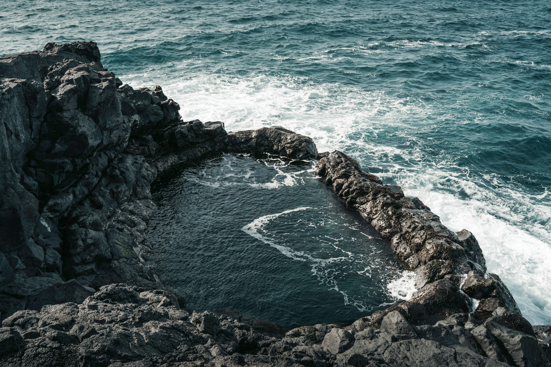
Brimketill lava rock pool on the Atlantic coast
  1. Home
  2. Destinations
  3. Brimketill
Stop 07

Brimketill

See a naturally formed coastal rock pool where Atlantic waves meet the lava shoreline.

All places Route map

At a glance

Accessibility
Not wheelchair accessible, viewing platform
Family-friendly
With caution
Walking difficulty
Short walk with stairs
Facilities
Parking available

Brimketill

  1. 01Why visit Brimketill?
  2. 02Walking and accessibility
  3. 03Before you set off
  4. 04Route map
  5. 05Next stops.

Why visit Brimketill?

Brimketill is a naturally carved pool at the edge of the lava shore west of Grindavík. It looks still from a distance, but its shape records a long conversation between basalt and the North Atlantic.

Local folklore gives the pool another layer, linking it with the giantess Oddný. Let the platform be the viewpoint and the waves be the subject; this is a place for watching coastal force, not entering the water.

Walking and accessibility

The viewing platform starts with steps, which Visit Reykjanes explicitly identifies as a barrier to wheelchair access. The parking area is nearby. Waves can reach the platform and surrounding area; keep children closely supervised and remain behind barriers. This is a viewpoint, not a swimming stop.

Visitor information source

Reviewed 9 September 2026.

Before you set off

Check road reports, local weather and current site access before travelling.

Local weather

Loading forecast

Reading the sky around this stop…

Icelandic Met Office

Latest road reports

Checking reports for Reykjanes…

Check current access

Route map

Brimketill is highlighted. Explore nearby stops and follow the road around the circle.

Calculating the mapped drive…

Preparing the route map…

Next stops.

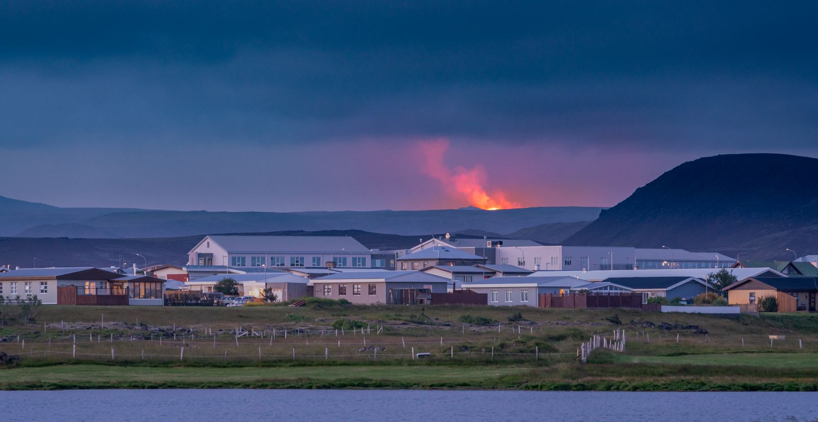
Grindavík with a volcanic eruption in the distance06

Grindavík

Grindavík is a fishing town on the Reykjanes Peninsula that has experienced significant volcanic activity in recent years. Explore the harbour, see cooled lava and fissures, enjoy local seafood, or visit nearby attractions. Allow 1–3 hours for a visit, or stay overnight while exploring the Volcano Circle.

Discover
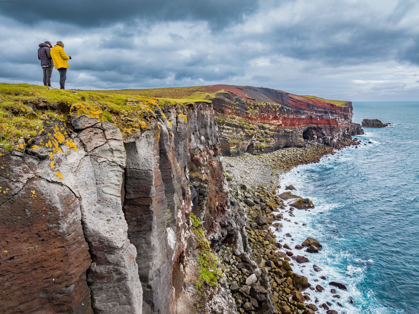
Rugged sea cliffs in the Krýsuvík area04

Krýsuvíkurberg

Krýsuvíkurberg brings you to the southern edge of the Reykjanes Peninsula, where long sea cliffs face the open Atlantic. The area is particularly known for its birdlife, with thousands of seabirds nesting along the cliffs during summer.

Discover
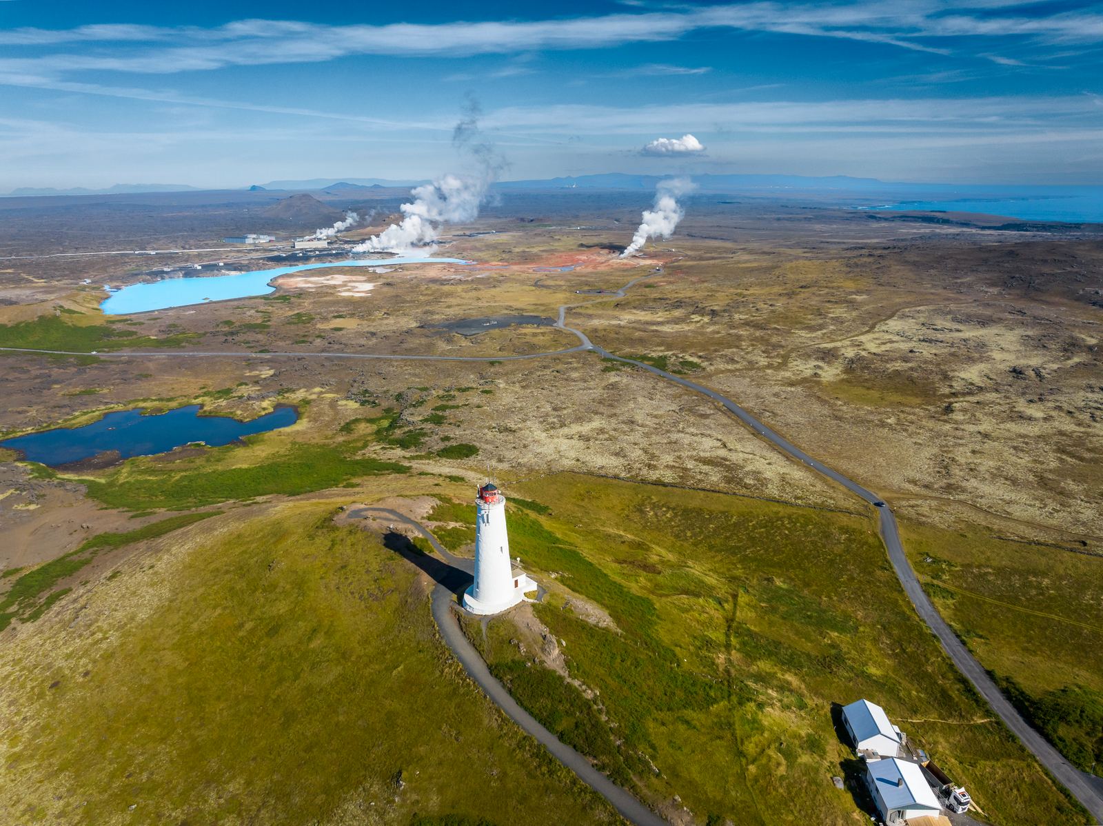
Reykjanes Lighthouse on its hill above the coast10

Reykjanes Lighthouse

Visit the landmark lighthouse near Gunnuhver and explore the surrounding lava coast.

Discover
Brimketill lava rock pool on the Atlantic coast
  1. Home
  2. Destinations
  3. Brimketill
Stop 07

Brimketill

See a naturally formed coastal rock pool where Atlantic waves meet the lava shoreline.

All places Route map

At a glance

Accessibility
Not wheelchair accessible, viewing platform
Family-friendly
With caution
Walking difficulty
Short walk with stairs
Facilities
Parking available

Brimketill

  1. 01Why visit Brimketill?
  2. 02Walking and accessibility
  3. 03Before you set off
  4. 04Route map
  5. 05Next stops.

Why visit Brimketill?

Brimketill is a naturally carved pool at the edge of the lava shore west of Grindavík. It looks still from a distance, but its shape records a long conversation between basalt and the North Atlantic.

Local folklore gives the pool another layer, linking it with the giantess Oddný. Let the platform be the viewpoint and the waves be the subject; this is a place for watching coastal force, not entering the water.

Walking and accessibility

The viewing platform starts with steps, which Visit Reykjanes explicitly identifies as a barrier to wheelchair access. The parking area is nearby. Waves can reach the platform and surrounding area; keep children closely supervised and remain behind barriers. This is a viewpoint, not a swimming stop.

Visitor information source

Reviewed 9 September 2026.

Before you set off

Check road reports, local weather and current site access before travelling.

Local weather

Loading forecast

Reading the sky around this stop…

Icelandic Met Office

Latest road reports

Checking reports for Reykjanes…

Check current access

Route map

Brimketill is highlighted. Explore nearby stops and follow the road around the circle.

Calculating the mapped drive…

Explore the circle

Loading the location map…

Brimketill lava rock pool on the Atlantic coast
Lava coast

Brimketill

See a naturally formed coastal rock pool where Atlantic waves meet the lava shoreline.

Explore this stop

Next stops.

Grindavík with a volcanic eruption in the distance06

Grindavík

Grindavík is a fishing town on the Reykjanes Peninsula that has experienced significant volcanic activity in recent years. Explore the harbour, see cooled lava and fissures, enjoy local seafood, or visit nearby attractions. Allow 1–3 hours for a visit, or stay overnight while exploring the Volcano Circle.

Discover
Rugged sea cliffs in the Krýsuvík area04

Krýsuvíkurberg

Krýsuvíkurberg brings you to the southern edge of the Reykjanes Peninsula, where long sea cliffs face the open Atlantic. The area is particularly known for its birdlife, with thousands of seabirds nesting along the cliffs during summer.

Discover
Reykjanes Lighthouse on its hill above the coast10

Reykjanes Lighthouse

Visit the landmark lighthouse near Gunnuhver and explore the surrounding lava coast.

Discover