What Is Special About Krýsuvík & Seltún?
Krýsuvík sits on the Mid-Atlantic Ridge, where the North American and Eurasian tectonic plates are slowly pulling apart. This location helps explain why the Reykjanes Peninsula has so much volcanic and geothermal activity.
Volcanic eruptions have shaped Krýsuvík over thousands of years, leaving behind lava fields, craters, and mountains. Heat remains underground, warming groundwater as it moves through cracks in the rock.
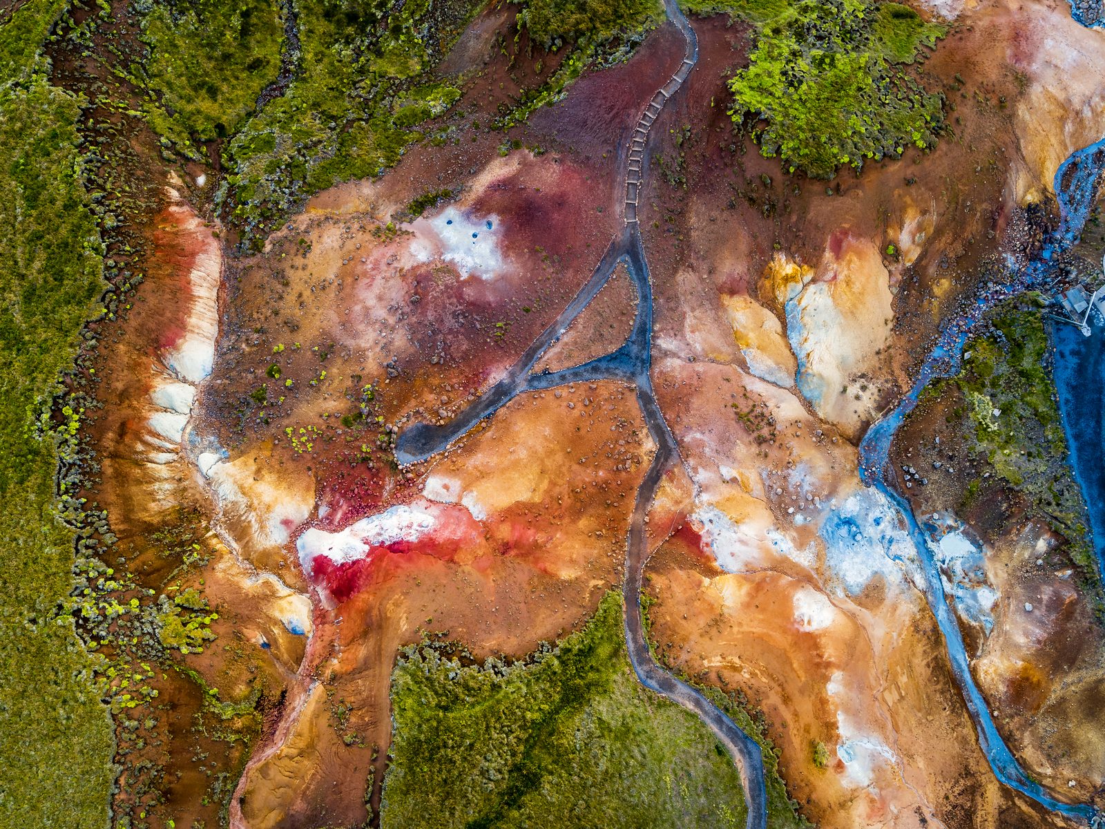
At Seltún, some of that heated water reaches the surface as hot springs and steam. In other places, it mixes with soil to form bubbling mud pools. Minerals in the water and steam also give the ground its yellow, red, green, and brown colours.
This combination of volcanic and geothermal activity makes Krýsuvík particularly interesting to explore. You can see signs of Iceland's active geology across a relatively small area, with Seltún providing the closest look.
Krýsuvík & Seltún, in pictures.
Best Way to Explore Krýsuvík & Seltún
You can keep your visit short and explore the main geothermal area or add a hike into the surrounding hills.
Walk the Seltún boardwalk
The Seltún boardwalk is the easiest way to explore the geothermal area up close. This short loop takes you past the main geothermal features, with viewpoints and information signs along the way.
Here’s what to know before you start:
Distance: 1.8 km (1.1 mi) loop
Walking difficulty: Easy
Time needed: 30–45 minutes at a relaxed pace
Terrain: Wooden boardwalk with some steps
Starting point: Seltún car park
The route is straightforward and doesn’t require hiking experience. However, there are some slopes and steps along the way. Surfaces can also become slippery during rain or in snowy and icy conditions.
Take your time as you walk around the loop. You can also stop at two viewing platforms for a closer look at the mud pools, steam vents, and colourful ground.
Important: As tempting as the colourful ground may look, don’t touch it or step off the boardwalk. Temperatures can reach 80–100°C (176–212°F), and the geothermal ground can be unstable.
Hike to Hverafjall
For a longer walk, continue beyond the main geothermal area and hike up Hverafjall. The route also starts at the Seltún car park and follows part of the boardwalk before heading uphill. (Latitude: 63.893750, Longitude: -22.066778)
Here’s what to expect:
Distance: 2.46 km (1.5 miles) out-and-back
Hike difficulty: Easy to moderate
Time needed: Around 1 hour
Elevation gain: Around 130 m (427 ft)
Maximum altitude: Around 287 m (942 ft)
Starting point: Seltún car park
The first part is easy, but the climb towards the top becomes steep. The trail is mostly gravel and dirt, so shoes with good grip are recommended.
Hverafjall is a good option for families or anyone looking for a short hike away from the main tourist route, with wide views over Kleifarvatn and the surrounding area.
How Do You Get to Krýsuvík & Seltún?
Krýsuvík and Seltún are on the southern Reykjanes Peninsula, around 40 kilometres (25 miles) from Reykjavík. Driving from the capital generally takes about 40 minutes.
From Reykjavík or Hafnarfjörður, follow Route 42 (Krýsuvíkurvegur) south towards Krýsuvík. The paved road passes Lake Kleifarvatn before reaching Seltún Hot Springs. Under normal conditions, a standard 2WD car is suitable, so you don’t need a 4x4 to get there.
Public transport is very limited in this part of the peninsula. For most visitors, driving or joining a guided tour is the easiest option.
In winter, snow and ice can make the journey more difficult. Icelandic weather and volcanic activity can also affect road conditions, so always check for updates before setting out.
Parking at Seltún Geothermal Area
There’s a designated car park right beside the Seltún Geothermal Area, just a short walk from the boardwalk.
You can pay at the on-site kiosk or online using the Parka app. Make sure to enter your licence plate correctly and pay before leaving. Rental companies may charge an additional administration fee if they receive the parking charge on your behalf.
Good to know: Entry to Seltún itself is free, and toilets are available in the car park area.
Before you set off
Check road reports, local weather and current site access before travelling.
Local weather
Loading forecastReading the sky around this stop…
Latest road reports
Checking reports for Reykjanes…
When Should You Visit Krýsuvík & Seltún?
Krýsuvík and Seltún can be visited year-round when road and weather conditions allow. The best time depends on how you want to experience the area:
For fewer visitors: Visit early in the morning or later in the evening, especially during summer. The long daylight hours give you plenty of flexibility.
For walking and hiking: Late spring through early autumn (May–September) generally offers the easiest conditions. Trails are more likely to be clear, making this the best time to hike Hverafjall.
For more visible steam: Cool weather during winter months (November–March) can make the steam rising from Seltún easier to see, particularly on calm days.
Whatever the season, check the weather and road conditions before setting out. In winter, be prepared to change your plans if conditions are poor.
What Else Is Worth Stopping for Around Krýsuvík?
There’s more to explore around Krýsuvík once you’ve finished at Seltún. Nearby stops include crater lakes, a historic church, and coastal cliffs:
Grænavatn: This small green lake fills an old explosion crater and reaches around 46 m (151 ft) deep. Its distinctive colour comes from minerals in the water.
Lake Kleifarvatn: The largest lake on the Reykjanes Peninsula lies north of Seltún. Route 42 follows its shoreline, making it an easy stop on your way to or from Krýsuvík.
Krýsuvíkurkirkja: Visit this small, traditional black church, rebuilt after the original was destroyed by fire in 2010. It offers a glimpse into Krýsuvík’s former farming community.
Krýsuvíkurberg: Continue south towards the coast to reach these rugged sea cliffs. During the breeding season, thousands of seabirds nest along the cliff faces.
These attractions are easy to combine when exploring Krýsuvík as part of a longer drive around the Reykjanes Peninsula.
Route map
Krýsuvík & Seltún is highlighted. Explore nearby stops and follow the road around the circle.
Calculating the mapped drive…
Where Do Krýsuvík & Seltún Fit on the Volcano Circle?
Travelling clockwise from Reykjavík, Krýsuvík and Seltún are the third stop on the Volcano Circle Iceland. You’ll reach them after driving along Lake Kleifarvatn on Route 42.
After exploring Seltún and the wider Krýsuvík area, continue south towards Krýsuvíkurberg. From there, the route carries on to Grindavík and the volcanic landscapes of the western Reykjanes Peninsula.
Allow 30–60 minutes for Seltún itself. Give yourself longer if you plan to hike Hverafjall or explore more of Krýsuvík before continuing the Volcano Circle.
Next stops.
 04
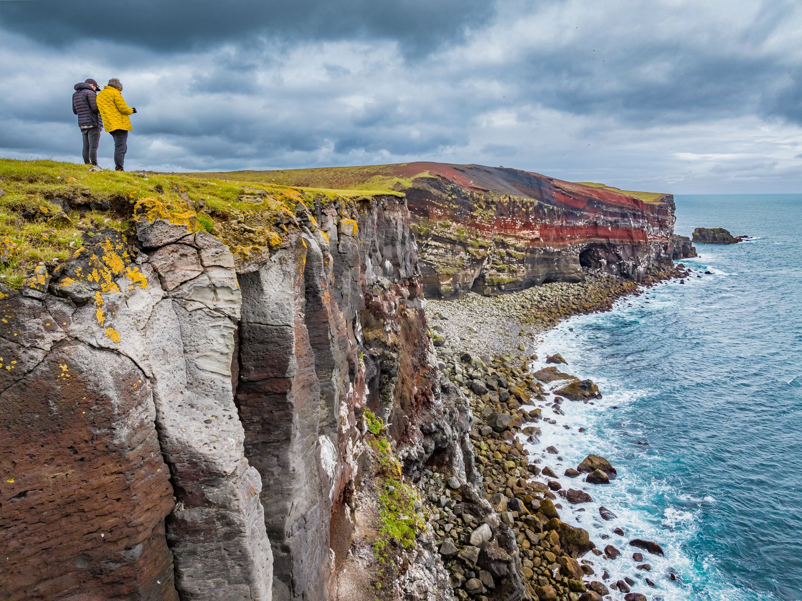
04Krýsuvíkurberg
Krýsuvíkurberg brings you to the southern edge of the Reykjanes Peninsula, where long sea cliffs face the open Atlantic. The area is particularly known for its birdlife, with thousands of seabirds nesting along the cliffs during summer.
Discover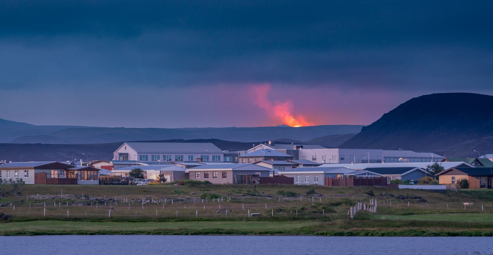 06
06Grindavík
Grindavík is a fishing town on the Reykjanes Peninsula that has experienced significant volcanic activity in recent years. Explore the harbour, see cooled lava and fissures, enjoy local seafood, or visit nearby attractions. Allow 1–3 hours for a visit, or stay overnight while exploring the Volcano Circle.
Discover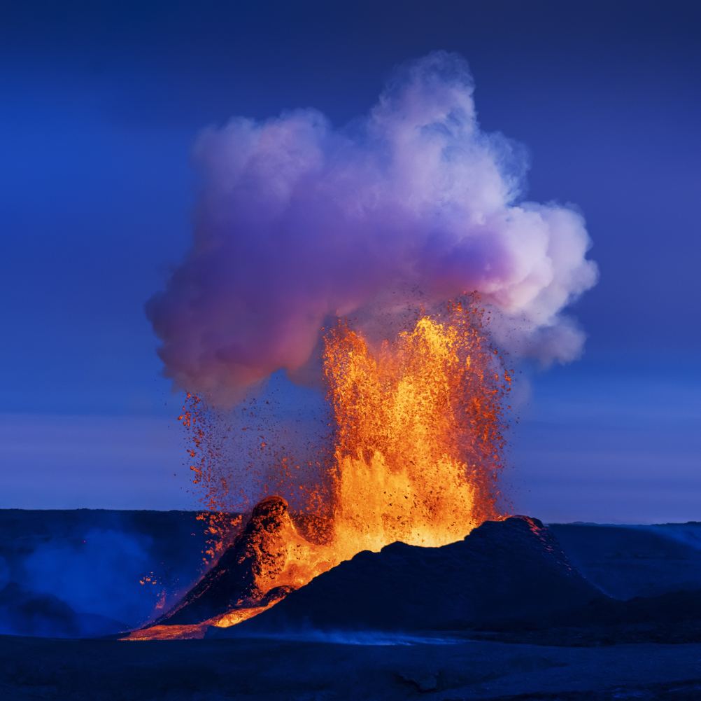 05
05Fagradalsfjall
Fagradalsfjall is known for the volcanic eruptions that created new lava fields between 2021 and 2023. Today, you can hike marked trails to viewpoints overlooking the eruption sites and solidified lava. Allow 3–6 hours, wear proper hiking gear, and always check current conditions before visiting.
Discover