Skip to contentThe Volcano
Circle
Explore the circleMapStoriesAbout
The Volcano Circle
DestinationsMapStoriesAbout
© 2026 The Volcano Circle
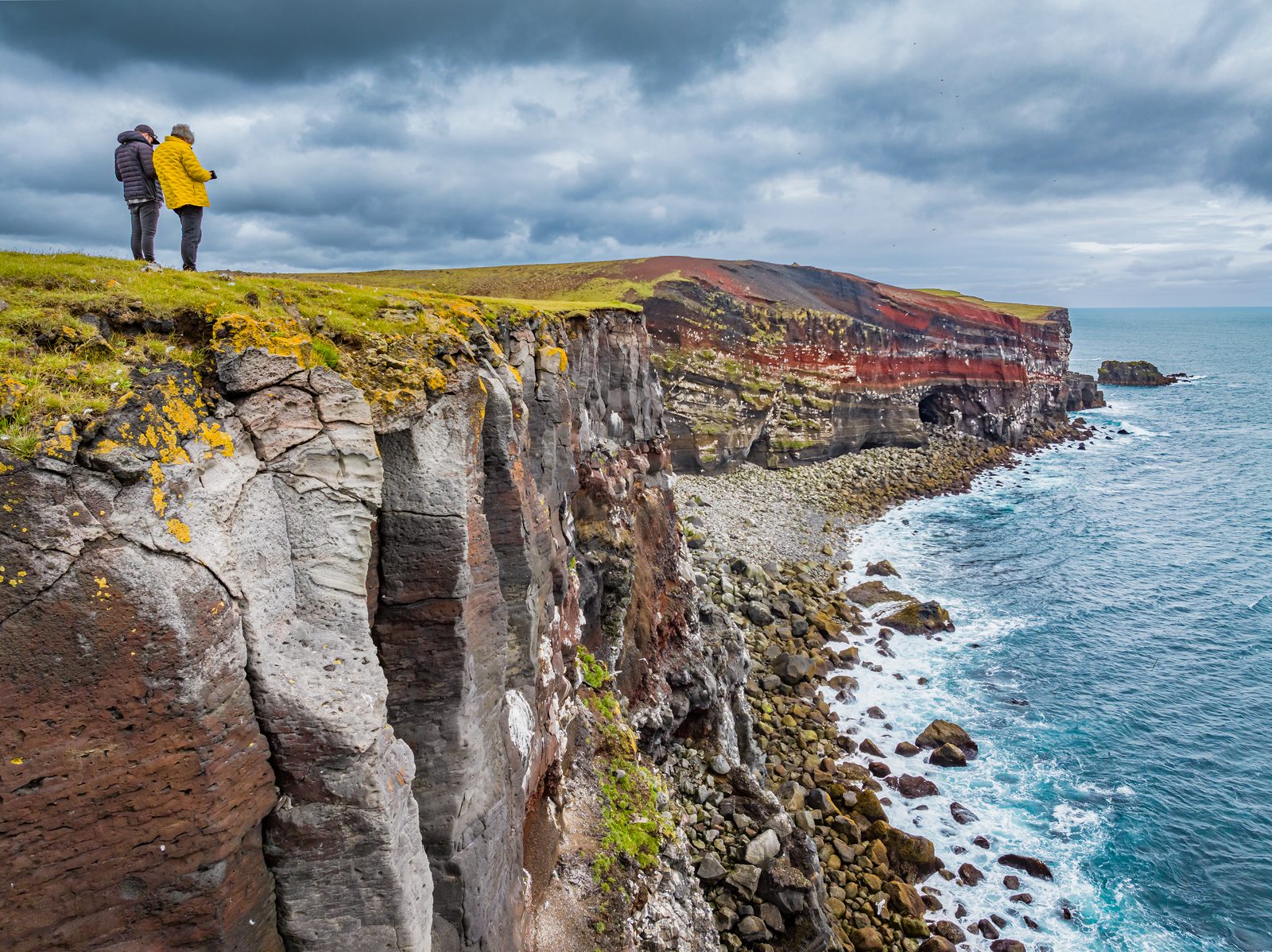
Rugged sea cliffs in the Krýsuvík area
  1. Home
  2. Destinations
  3. Krýsuvíkurberg
Stop 04

Krýsuvíkurberg

Krýsuvíkurberg brings you to the southern edge of the Reykjanes Peninsula, where long sea cliffs face the open Atlantic. The area is particularly known for its birdlife, with thousands of seabirds nesting along the cliffs during summer.

All places Route map

At a glance

Accessibility
Not suitable for wheelchairs
Family-friendly
Possible with older children, but extra care is needed near the cliffs
Time needed
Around 1–2 hours, depending on how far you walk
Walking difficulty
Easy to moderate, but exposed to wind and weather
Facilities
Free car park
Toilets
There are no toilets or other visitor facilities here
Road types
The final section is a rough gravel road with potholes and deep ruts in places
Seasonality
Late spring to early autumn (May–September)

Krýsuvíkurberg

  1. 01What is Krýsuvíkurberg?
  2. 02What Can You See at Krýsuvíkurberg Cliffs?
  3. 03How Do You Get to Krýsuvíkurberg Cliffs?
  4. 04Route map
  5. 05What Is Hiking at Krýsuvíkurberg Like?
  6. 06How Can You Visit Krýsuvíkurberg Cliffs Safely?
  7. 07When Should You Visit Krýsuvíkurberg Cliffs?
  8. 08Before you set off
  9. 09What Can You See Near Krýsuvíkurberg Cliffs?
  10. 10Where Does Krýsuvíkurberg Fit on the Volcano Circle?
  11. 11Next stops.
  12. 12Frequently asked questions

What is Krýsuvíkurberg?

Krýsuvíkurberg is a long line of sea cliffs on the south coast of the Reykjanes Peninsula. It’s part of the Reykjanes UNESCO Global Geopark, along with other natural attractions in the region. You may also see the area called Krýsuvíkurbjarg or Krísuvíkurberg on maps and travel information.

The cliffs stretch for around 15 kilometres (9 miles) and reach roughly 40–50 metres (132–164 feet) above the sea. Layers of old lava are visible in the cliff faces, showing how repeated volcanic activity helped build this coastline.

Today, Krýsuvíkurberg is especially important for birds. It’s the largest bird cliff on the Reykjanes Peninsula, with tens of thousands of seabirds nesting here during summer.

What Can You See at Krýsuvíkurberg Cliffs?

Krýsuvíkurberg has more to see than the cliffs alone. As you explore, look out for seabirds, the small coastal lighthouse, and a seasonal waterfall that drops towards the sea.

1. Krýsuvíkurberg Sea Cliffs

The cliffs themselves are the main reason to visit. They form a long wall above the Atlantic, with waves breaking against the rocks below. Over time, the sea has carved steep ledges into the cliffs, providing nesting sites for seabirds in summer. Look closely at the cliff face, and you can also see layers of lava formed by different volcanic events.

You don’t need to walk the full length of Krýsuvíkurberg to appreciate the scenery. Even a short walk offers views along the coast. Those with more time can continue farther along the cliffs.

2. Birdlife at Krýsuvíkurberg

Bring binoculars if you have them. Krýsuvíkurberg becomes a busy nesting area during summer, when thousands of seabirds gather on narrow ledges along the cliffs.

Common species include black-legged kittiwakes, common guillemots, Brünnich's guillemots and razorbills. Fulmars, shags, black guillemots and several gull species can also be seen. Puffins nest here too, though in much smaller numbers.

Around 57,000 pairs of seabirds have been recorded at Krýsuvíkurberg, making it the largest bird cliff on Reykjanes.

Important: Keep your distance from nesting birds and avoid disturbing them. A pair of binoculars or a zoom lens gives you a much better look without getting too close.

3. Krísuvíkurberg Lighthouse

Continue along the coast, and you will come across Krýsuvíkurviti, a small orange lighthouse standing above the sea. The current lighthouse dates from 1965 and stands just 5 m (16 ft) tall. The eastern side is particularly scenic. From here, you can take in the lighthouse, cliffs, waves, and seabirds together. 

The lighthouse isn’t open to visitors. However, it serves as a useful landmark and a good first scenic viewpoint on a walk along the cliffs.

4. The hidden Krýsuvíkurberg Waterfall

There’s another feature farther east that is easy to miss. A small stream called Eystri-Lækur reaches the edge of the cliffs and drops directly towards the sea. This creates a waterfall with no official name, although it’s sometimes referred to as Krýsuvíkurfoss.

The waterfall is partly hidden by the cliffs, so you won’t see it clearly from afar. The best view is from farther east, where you can look back towards the water dropping over the cliff.

There is one catch: it’s not always flowing. The stream depends heavily on rainfall and snowmelt, so the waterfall can become very small or even disappear during dry periods. Your chances of seeing it are better after heavy rain or during the spring thaw.

How Do You Get to Krýsuvíkurberg Cliffs?

Krýsuvíkurberg can be approached from either the east or west along Road 427 (Suðurstrandarvegur). However, volcanic activity can affect access from the west, so always check current road conditions before setting out.

Note: There’s no public transport to Krýsuvíkurberg, so you’ll need to drive or arrange a private transfer.

From Road 427, turn onto the road towards Hælsvík and follow it south towards the coast. The final section is a rough gravel road with potholes and deep ruts in places, so drive slowly and carefully. It’s generally manageable in a 2WD car during good summer conditions. However, a 4WD is recommended in winter or when conditions are poor.

Don’t drive beyond signs, gates, or restrictions simply because tyre tracks are visible. Some tracks are used by landowners rather than visitors.

Route map

Krýsuvíkurberg is highlighted. Explore nearby stops and follow the road around the circle.

Calculating the mapped drive…

Preparing the route map…

Parking at Krýsuvíkurberg

At the end of the access road, you’ll reach a free, open parking area near the trailhead. There are no toilets or other visitor facilities here.

You can already get a glimpse of the coastal scenery from the nearby lookout. From the trailhead, the route continues east along Krýsuvíkurberg towards the lighthouse, bird cliffs, and seasonal waterfall.

What Is Hiking at Krýsuvíkurberg Like?

Hiking is the best way to explore Krýsuvíkurberg beyond the first viewpoint. The route takes you east along the coast, passing the sea cliffs, birdlife, lighthouse, and seasonal waterfall.

For the walk to the waterfall and back, here’s what to expect:

  • Distance: 5.46 km (3.4 miles) out-and-back

  • Hiking time: 1.5–2 hours

  • Difficulty: Easy to moderate

  • Elevation gain: Around 50 m (164 ft)

  • Maximum altitude: 68 m (223 ft)

The trail starts at the car park and follows an old dirt road east along the coast. Most of the route is relatively flat. The main climb comes near the beginning, as you walk from the car park up towards the first cliffs.

After around 2 km (1.2 miles), you’ll reach Krýsuvíkurviti Lighthouse. From there, continue east along the cliffs for roughly 900 m (0.6 miles) to reach the waterfall area. The trail continues farther east, so you can extend your walk if conditions and time allow.

The main challenge is the exposed coastal setting rather than steep terrain. Strong winds, rain, and wet ground can make the hike more demanding. Wear sturdy footwear and bring waterproof and windproof layers.

How Can You Visit Krýsuvíkurberg Cliffs Safely?

Krýsuvíkurberg is an exposed coastal area with few visitor facilities or safety barriers. Keep these precautions in mind during your visit:

  • Stay well back from the cliff edge: The ground can be uneven or unstable, and there are no barriers along much of the route.

  • Be prepared for strong winds: Sudden gusts can make walking near the cliffs dangerous. Avoid hiking in very strong winds or poor visibility.

  • Wear suitable clothing and footwear: Dress in layers and bring waterproof and windproof outerwear. Sturdy walking shoes are recommended, especially when the ground is wet.

  • Watch the birds without disturbing them: Move slowly and quietly around nesting areas. Avoid loud noises and flash photography, and keep a respectful distance from the birds.

  • Check conditions before setting out: Look at the weather and current road conditions before driving to Krýsuvíkurberg. Check out vedur.is, road.is, or safetravel.is for updates.

  • Come prepared: There are no toilets, shops, shelters, or other facilities at the cliffs. Bring water and anything else you may need.

When Should You Visit Krýsuvíkurberg Cliffs?

Late spring through summer is generally the best time to visit Krýsuvíkurberg. However, the right time depends on what you want to see and do:

  • For birdwatching: Visit from late spring through summer (May–August), when thousands of seabirds gather along the cliffs to nest.

  • For the waterfall: Spring (April–May) is a good time to see the seasonal waterfall, as melting snow can increase its flow. It may also flow more strongly after periods of heavy rain.

  • For hiking: Summer (June–August) generally offers the easiest walking conditions, with long daylight hours and milder weather. The trail can become wet, icy, or more difficult outside the warmer months.

  • For a quieter visit: Autumn (September–October) brings fewer nesting birds but also fewer summer visitors. Rainier conditions may increase the waterfall's flow, although stronger winds and shorter days can affect hiking.

Winter visits are possible when conditions allow, but snow, ice, strong winds, and limited daylight can make access more difficult. Whatever time you visit, check the weather and road conditions before heading to Krýsuvíkurberg.

Before you set off

Check road reports, local weather and current site access before travelling.

Local weather

Loading forecast

Reading the sky around this stop…

Icelandic Met Office

Latest road reports

Checking reports for Reykjanes…

Check current access

What Can You See Near Krýsuvíkurberg Cliffs?

Several other Reykjanes attractions are within easy driving distance of Krýsuvíkurberg. If you have more time to explore the area, consider adding these nearby stops to your trip:

  • Krýsuvík & Seltún: Explore marked paths through an active geothermal area filled with steaming vents, bubbling mud, and colourful ground.

  • Kleifarvatn Lake: Visit the largest lake on the Reykjanes Peninsula, surrounded by volcanic landscapes and viewpoints along the road.

  • Selatangar: Explore the remains of an old fishing station on the coast. Stone ruins and pathways offer a glimpse into fishing life in Reykjanes centuries ago.

  • Fagradalsfjall: Hike through an area shaped by the volcanic eruptions that began in 2021. Access and trail conditions can change, so check current information before visiting.

Where Does Krýsuvíkurberg Fit on the Volcano Circle?

Krýsuvíkurberg follows Krýsuvík & Seltún on the Volcano Circle Iceland, taking you from the geothermal landscapes around Route 42 to the coast. After exploring the cliffs, the route continues west towards Grindavík.

Set aside at least an hour for Krýsuvíkurberg. You’ll need longer if you want to walk to the lighthouse or seasonal waterfall before continuing your drive.

Next stops.
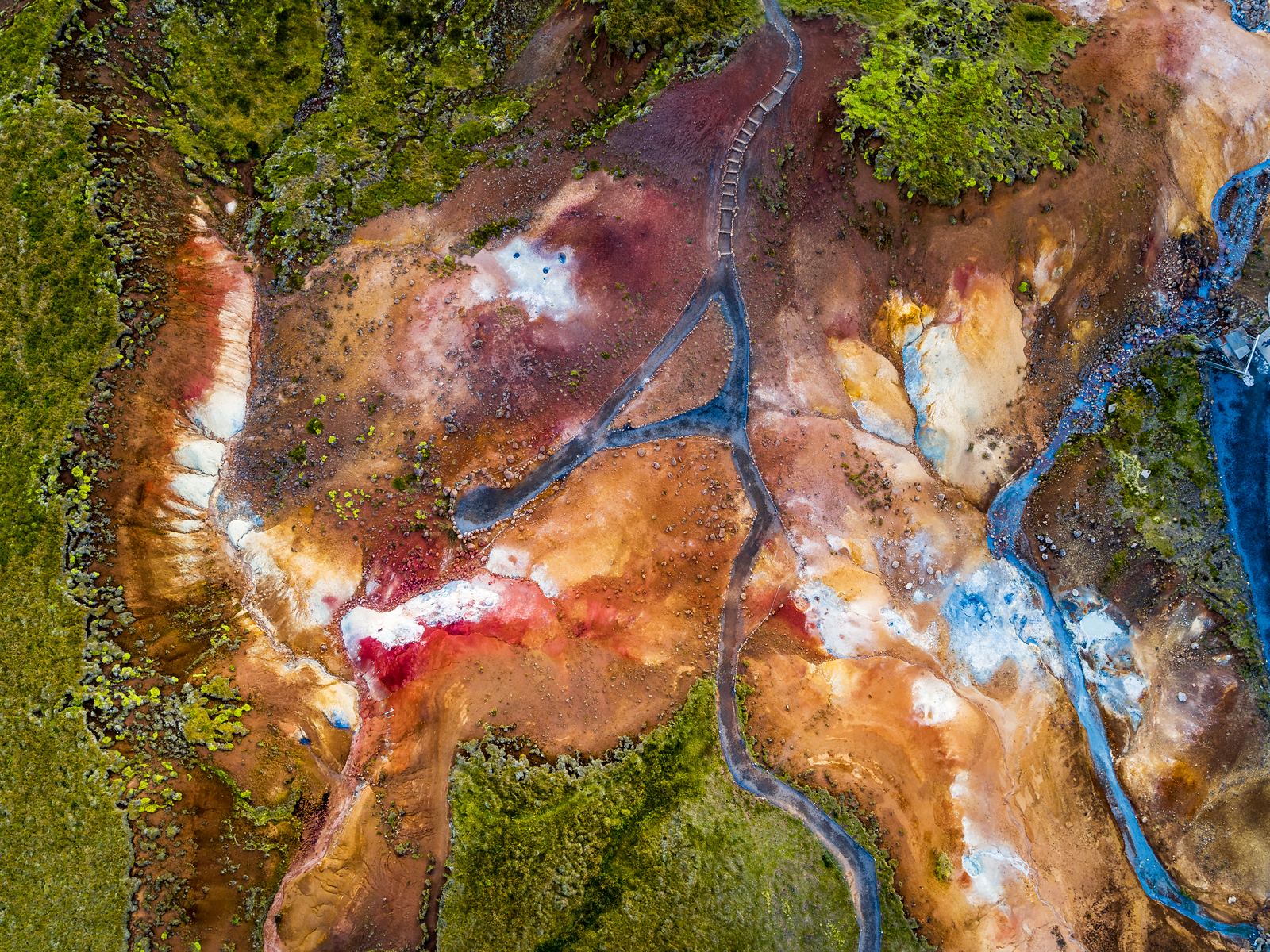
Colourful geothermal ground and steaming vents at Seltún03

Krýsuvík & Seltún

At Krýsuvík & Seltún, the geothermal activity is noticeable as soon as you step out of the car. You can see the steam, hear the bubbling mud pools, and smell the sulphur in the air. Follow the boardwalk for a closer look at the geothermal features that make this one of the most distinctive stops on the Reykjanes Peninsula.

Discover
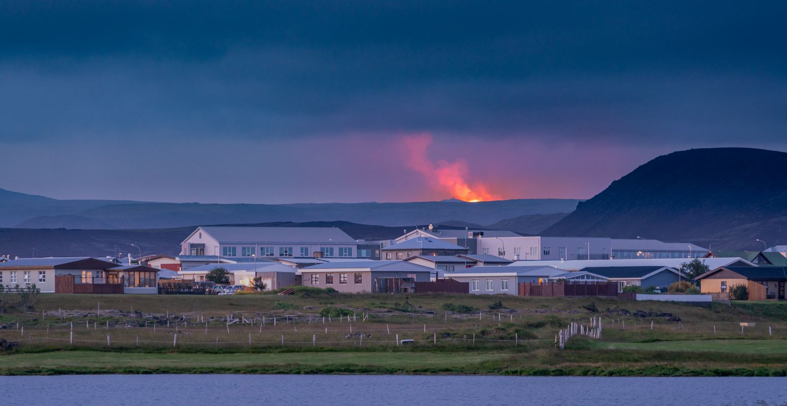
Grindavík with a volcanic eruption in the distance06

Grindavík

Grindavík is a fishing town on the Reykjanes Peninsula that has experienced significant volcanic activity in recent years. Explore the harbour, see cooled lava and fissures, enjoy local seafood, or visit nearby attractions. Allow 1–3 hours for a visit, or stay overnight while exploring the Volcano Circle.

Discover
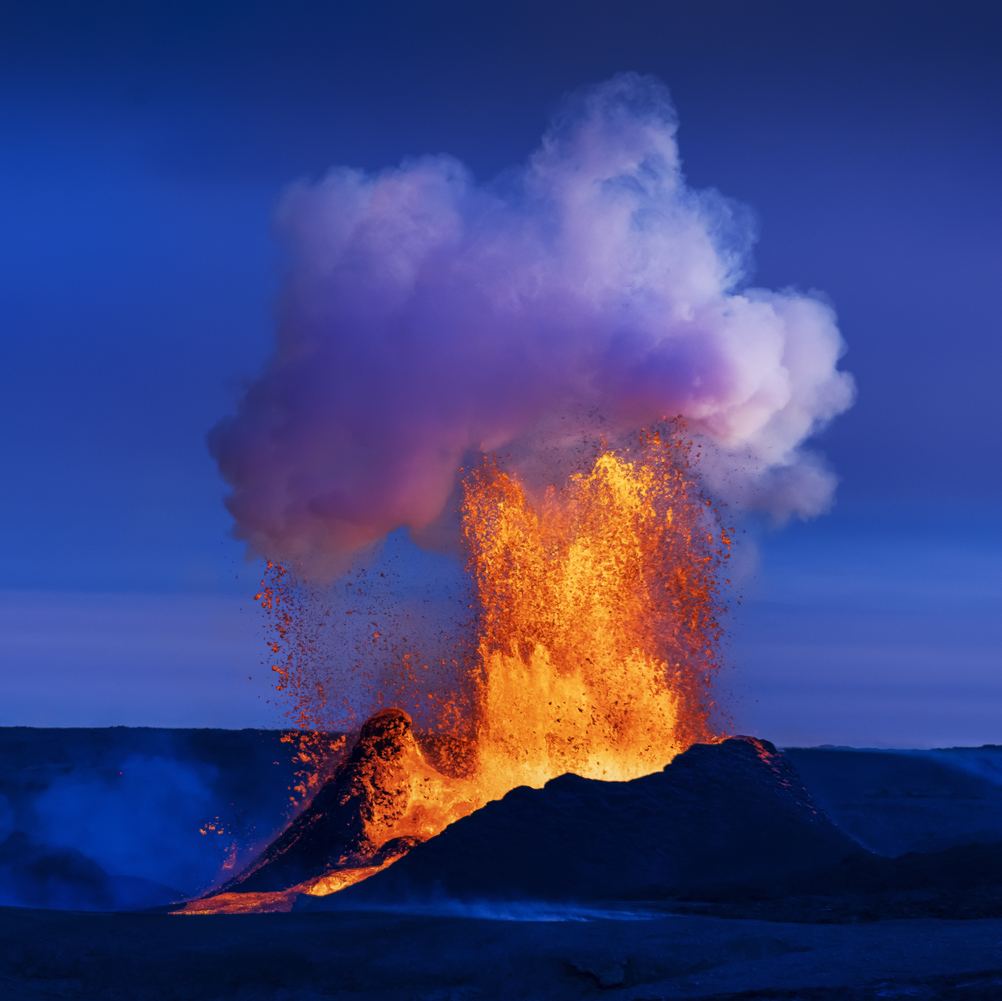
Lava erupting at Fagradalsfjall beneath a blue sky05

Fagradalsfjall

Fagradalsfjall is known for the volcanic eruptions that created new lava fields between 2021 and 2023. Today, you can hike marked trails to viewpoints overlooking the eruption sites and solidified lava. Allow 3–6 hours, wear proper hiking gear, and always check current conditions before visiting.

Discover

Frequently asked questions

Yes, Krýsuvíkurberg is worth visiting, especially if you enjoy coastal walks or birdwatching. Its quiet setting and undeveloped trails offer a more peaceful way to experience the coast of Reykjanes.

Not necessarily, as the gravel road to the Krýsuvíkurberg car park is generally manageable in a 2WD car during summer. However, a 4WD is recommended in winter or when road conditions are poor.

Allow around 1–2 hours at Krýsuvíkurberg Cliffs. This gives you enough time to hike to the waterfall and back, with stops at the lighthouse and viewpoints along the way.

Yes, puffins can nest at Krýsuvíkurberg during summer. However, they are much less numerous here than guillemots, kittiwakes and razorbills, so sightings aren’t guaranteed.

Yes, older children who are comfortable walking outdoors can visit Krýsuvíkurberg, but close supervision is essential. There are steep cliff edges, exposed terrain, and few safety barriers.

Rugged sea cliffs in the Krýsuvík area
  1. Home
  2. Destinations
  3. Krýsuvíkurberg
Stop 09

Krýsuvíkurberg

Krýsuvíkurberg brings you to the southern edge of the Reykjanes Peninsula, where long sea cliffs face the open Atlantic. The area is particularly known for its birdlife, with thousands of seabirds nesting along the cliffs during summer.

All places Route map

At a glance

Accessibility
Not suitable for wheelchairs
Family-friendly
Possible with older children, but extra care is needed near the cliffs
Time needed
Around 1–2 hours, depending on how far you walk
Walking difficulty
Easy to moderate, but exposed to wind and weather
Facilities
Free car park
Toilets
There are no toilets or other visitor facilities here
Road types
The final section is a rough gravel road with potholes and deep ruts in places
Seasonality
Late spring to early autumn (May–September)

Krýsuvíkurberg

  1. 01What is Krýsuvíkurberg?
  2. 02What Can You See at Krýsuvíkurberg Cliffs?
  3. 03How Do You Get to Krýsuvíkurberg Cliffs?
  4. 04Route map
  5. 05What Is Hiking at Krýsuvíkurberg Like?
  6. 06How Can You Visit Krýsuvíkurberg Cliffs Safely?
  7. 07When Should You Visit Krýsuvíkurberg Cliffs?
  8. 08Before you set off
  9. 09What Can You See Near Krýsuvíkurberg Cliffs?
  10. 10Where Does Krýsuvíkurberg Fit on the Volcano Circle?
  11. 11Next stops.
  12. 12Frequently asked questions

What is Krýsuvíkurberg?

Krýsuvíkurberg is a long line of sea cliffs on the south coast of the Reykjanes Peninsula. It’s part of the Reykjanes UNESCO Global Geopark, along with other natural attractions in the region. You may also see the area called Krýsuvíkurbjarg or Krísuvíkurberg on maps and travel information.

The cliffs stretch for around 15 kilometres (9 miles) and reach roughly 40–50 metres (132–164 feet) above the sea. Layers of old lava are visible in the cliff faces, showing how repeated volcanic activity helped build this coastline.

Today, Krýsuvíkurberg is especially important for birds. It’s the largest bird cliff on the Reykjanes Peninsula, with tens of thousands of seabirds nesting here during summer.

What Can You See at Krýsuvíkurberg Cliffs?

Krýsuvíkurberg has more to see than the cliffs alone. As you explore, look out for seabirds, the small coastal lighthouse, and a seasonal waterfall that drops towards the sea.

1. Krýsuvíkurberg Sea Cliffs

The cliffs themselves are the main reason to visit. They form a long wall above the Atlantic, with waves breaking against the rocks below. Over time, the sea has carved steep ledges into the cliffs, providing nesting sites for seabirds in summer. Look closely at the cliff face, and you can also see layers of lava formed by different volcanic events.

You don’t need to walk the full length of Krýsuvíkurberg to appreciate the scenery. Even a short walk offers views along the coast. Those with more time can continue farther along the cliffs.

2. Birdlife at Krýsuvíkurberg

Bring binoculars if you have them. Krýsuvíkurberg becomes a busy nesting area during summer, when thousands of seabirds gather on narrow ledges along the cliffs.

Common species include black-legged kittiwakes, common guillemots, Brünnich's guillemots and razorbills. Fulmars, shags, black guillemots and several gull species can also be seen. Puffins nest here too, though in much smaller numbers.

Around 57,000 pairs of seabirds have been recorded at Krýsuvíkurberg, making it the largest bird cliff on Reykjanes.

Important: Keep your distance from nesting birds and avoid disturbing them. A pair of binoculars or a zoom lens gives you a much better look without getting too close.

3. Krísuvíkurberg Lighthouse

Continue along the coast, and you will come across Krýsuvíkurviti, a small orange lighthouse standing above the sea. The current lighthouse dates from 1965 and stands just 5 m (16 ft) tall. The eastern side is particularly scenic. From here, you can take in the lighthouse, cliffs, waves, and seabirds together. 

The lighthouse isn’t open to visitors. However, it serves as a useful landmark and a good first scenic viewpoint on a walk along the cliffs.

4. The hidden Krýsuvíkurberg Waterfall

There’s another feature farther east that is easy to miss. A small stream called Eystri-Lækur reaches the edge of the cliffs and drops directly towards the sea. This creates a waterfall with no official name, although it’s sometimes referred to as Krýsuvíkurfoss.

The waterfall is partly hidden by the cliffs, so you won’t see it clearly from afar. The best view is from farther east, where you can look back towards the water dropping over the cliff.

There is one catch: it’s not always flowing. The stream depends heavily on rainfall and snowmelt, so the waterfall can become very small or even disappear during dry periods. Your chances of seeing it are better after heavy rain or during the spring thaw.

How Do You Get to Krýsuvíkurberg Cliffs?

Krýsuvíkurberg can be approached from either the east or west along Road 427 (Suðurstrandarvegur). However, volcanic activity can affect access from the west, so always check current road conditions before setting out.

Note: There’s no public transport to Krýsuvíkurberg, so you’ll need to drive or arrange a private transfer.

From Road 427, turn onto the road towards Hælsvík and follow it south towards the coast. The final section is a rough gravel road with potholes and deep ruts in places, so drive slowly and carefully. It’s generally manageable in a 2WD car during good summer conditions. However, a 4WD is recommended in winter or when conditions are poor.

Don’t drive beyond signs, gates, or restrictions simply because tyre tracks are visible. Some tracks are used by landowners rather than visitors.

Route map

Krýsuvíkurberg is highlighted. Explore nearby stops and follow the road around the circle.

Calculating the mapped drive…

Explore the circle

Loading the location map…

Rugged sea cliffs in the Krýsuvík area
Coastal cliffs

Krýsuvíkurberg

Krýsuvíkurberg brings you to the southern edge of the Reykjanes Peninsula, where long sea cliffs face the open Atlantic. The area is particularly known for its birdlife, with thousands of seabirds nesting along the cliffs during summer.

Explore this stop

Parking at Krýsuvíkurberg

At the end of the access road, you’ll reach a free, open parking area near the trailhead. There are no toilets or other visitor facilities here.

You can already get a glimpse of the coastal scenery from the nearby lookout. From the trailhead, the route continues east along Krýsuvíkurberg towards the lighthouse, bird cliffs, and seasonal waterfall.

What Is Hiking at Krýsuvíkurberg Like?

Hiking is the best way to explore Krýsuvíkurberg beyond the first viewpoint. The route takes you east along the coast, passing the sea cliffs, birdlife, lighthouse, and seasonal waterfall.

For the walk to the waterfall and back, here’s what to expect:

  • Distance: 5.46 km (3.4 miles) out-and-back

  • Hiking time: 1.5–2 hours

  • Difficulty: Easy to moderate

  • Elevation gain: Around 50 m (164 ft)

  • Maximum altitude: 68 m (223 ft)

The trail starts at the car park and follows an old dirt road east along the coast. Most of the route is relatively flat. The main climb comes near the beginning, as you walk from the car park up towards the first cliffs.

After around 2 km (1.2 miles), you’ll reach Krýsuvíkurviti Lighthouse. From there, continue east along the cliffs for roughly 900 m (0.6 miles) to reach the waterfall area. The trail continues farther east, so you can extend your walk if conditions and time allow.

The main challenge is the exposed coastal setting rather than steep terrain. Strong winds, rain, and wet ground can make the hike more demanding. Wear sturdy footwear and bring waterproof and windproof layers.

How Can You Visit Krýsuvíkurberg Cliffs Safely?

Krýsuvíkurberg is an exposed coastal area with few visitor facilities or safety barriers. Keep these precautions in mind during your visit:

  • Stay well back from the cliff edge: The ground can be uneven or unstable, and there are no barriers along much of the route.

  • Be prepared for strong winds: Sudden gusts can make walking near the cliffs dangerous. Avoid hiking in very strong winds or poor visibility.

  • Wear suitable clothing and footwear: Dress in layers and bring waterproof and windproof outerwear. Sturdy walking shoes are recommended, especially when the ground is wet.

  • Watch the birds without disturbing them: Move slowly and quietly around nesting areas. Avoid loud noises and flash photography, and keep a respectful distance from the birds.

  • Check conditions before setting out: Look at the weather and current road conditions before driving to Krýsuvíkurberg. Check out vedur.is, road.is, or safetravel.is for updates.

  • Come prepared: There are no toilets, shops, shelters, or other facilities at the cliffs. Bring water and anything else you may need.

When Should You Visit Krýsuvíkurberg Cliffs?

Late spring through summer is generally the best time to visit Krýsuvíkurberg. However, the right time depends on what you want to see and do:

  • For birdwatching: Visit from late spring through summer (May–August), when thousands of seabirds gather along the cliffs to nest.

  • For the waterfall: Spring (April–May) is a good time to see the seasonal waterfall, as melting snow can increase its flow. It may also flow more strongly after periods of heavy rain.

  • For hiking: Summer (June–August) generally offers the easiest walking conditions, with long daylight hours and milder weather. The trail can become wet, icy, or more difficult outside the warmer months.

  • For a quieter visit: Autumn (September–October) brings fewer nesting birds but also fewer summer visitors. Rainier conditions may increase the waterfall's flow, although stronger winds and shorter days can affect hiking.

Winter visits are possible when conditions allow, but snow, ice, strong winds, and limited daylight can make access more difficult. Whatever time you visit, check the weather and road conditions before heading to Krýsuvíkurberg.

Before you set off

Check road reports, local weather and current site access before travelling.

Local weather

Loading forecast

Reading the sky around this stop…

Icelandic Met Office

Latest road reports

Checking reports for Reykjanes…

Check current access

What Can You See Near Krýsuvíkurberg Cliffs?

Several other Reykjanes attractions are within easy driving distance of Krýsuvíkurberg. If you have more time to explore the area, consider adding these nearby stops to your trip:

  • Krýsuvík & Seltún: Explore marked paths through an active geothermal area filled with steaming vents, bubbling mud, and colourful ground.

  • Kleifarvatn Lake: Visit the largest lake on the Reykjanes Peninsula, surrounded by volcanic landscapes and viewpoints along the road.

  • Selatangar: Explore the remains of an old fishing station on the coast. Stone ruins and pathways offer a glimpse into fishing life in Reykjanes centuries ago.

  • Fagradalsfjall: Hike through an area shaped by the volcanic eruptions that began in 2021. Access and trail conditions can change, so check current information before visiting.

Where Does Krýsuvíkurberg Fit on the Volcano Circle?

Krýsuvíkurberg follows Krýsuvík & Seltún on the Volcano Circle Iceland, taking you from the geothermal landscapes around Route 42 to the coast. After exploring the cliffs, the route continues west towards Grindavík.

Set aside at least an hour for Krýsuvíkurberg. You’ll need longer if you want to walk to the lighthouse or seasonal waterfall before continuing your drive.

Next stops.

Colourful geothermal ground and steaming vents at Seltún10

Krýsuvík & Seltún

At Krýsuvík & Seltún, the geothermal activity is noticeable as soon as you step out of the car. You can see the steam, hear the bubbling mud pools, and smell the sulphur in the air. Follow the boardwalk for a closer look at the geothermal features that make this one of the most distinctive stops on the Reykjanes Peninsula.

Discover
Grindavík with a volcanic eruption in the distance07

Grindavík

Grindavík is a fishing town on the Reykjanes Peninsula that has experienced significant volcanic activity in recent years. Explore the harbour, see cooled lava and fissures, enjoy local seafood, or visit nearby attractions. Allow 1–3 hours for a visit, or stay overnight while exploring the Volcano Circle.

Discover
Lava erupting at Fagradalsfjall beneath a blue sky08

Fagradalsfjall

Fagradalsfjall is known for the volcanic eruptions that created new lava fields between 2021 and 2023. Today, you can hike marked trails to viewpoints overlooking the eruption sites and solidified lava. Allow 3–6 hours, wear proper hiking gear, and always check current conditions before visiting.

Discover

Frequently asked questions

Yes, Krýsuvíkurberg is worth visiting, especially if you enjoy coastal walks or birdwatching. Its quiet setting and undeveloped trails offer a more peaceful way to experience the coast of Reykjanes.

Not necessarily, as the gravel road to the Krýsuvíkurberg car park is generally manageable in a 2WD car during summer. However, a 4WD is recommended in winter or when road conditions are poor.

Allow around 1–2 hours at Krýsuvíkurberg Cliffs. This gives you enough time to hike to the waterfall and back, with stops at the lighthouse and viewpoints along the way.

Yes, puffins can nest at Krýsuvíkurberg during summer. However, they are much less numerous here than guillemots, kittiwakes and razorbills, so sightings aren’t guaranteed.

Yes, older children who are comfortable walking outdoors can visit Krýsuvíkurberg, but close supervision is essential. There are steep cliff edges, exposed terrain, and few safety barriers.