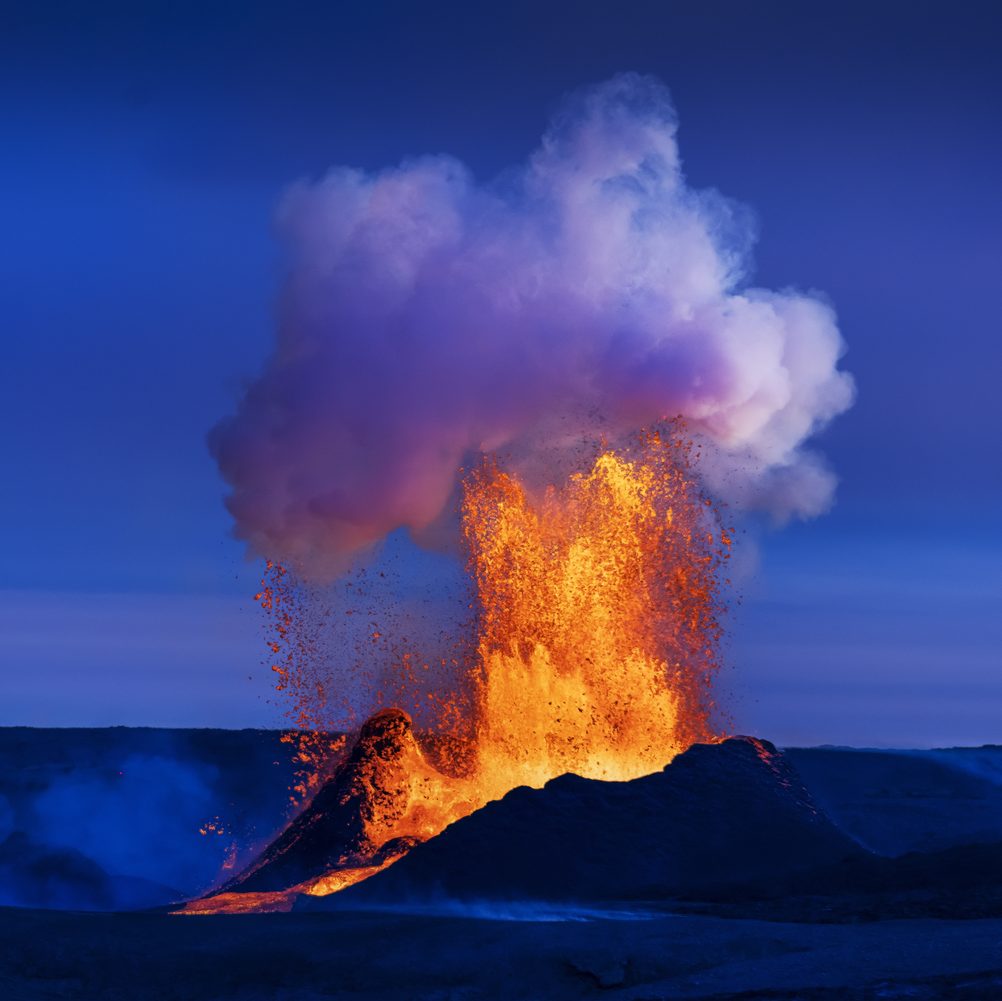
Fagradalsfjall changed Iceland's volcanic landscape when an eruption began here in March 2021. It was the first eruption in this area for around 6,000 years. It also marked the beginning of a new period of volcanic activity on the Reykjanes Peninsula.
Today, you can hike through the area and see craters, rugged lava fields, and fresh lava flows from recent eruptions. Fagradalsfjall is also within easy reach of Reykjavík and Keflavík International Airport. This makes it a convenient place to explore Iceland's recent volcanic history.
When Did the Fagradalsfjall Volcano Erupt?
The Fagradalsfjall eruption began in Geldingadalir on 19 March 2021. A fissure opened after weeks of earthquakes, allowing lava to spread across the valley. The eruption continued for around six months before activity stopped and was officially declared over in December 2021. Before this event, the Fagradalsfjall area had not erupted for at least 6,000 years.
The quiet did not last long. Another fissure eruption began in nearby Meradalir on 3 August 2022. The 2022 volcano eruption was shorter, lasting for about two weeks. A third, more powerful eruption began near Litli-Hrútur in July 2023 and lasted until August 2023. These 2021–2023 eruptions created extensive new lava fields.
Volcanic activity later shifted towards the Sundhnúkur Crater Row near Grindavík. These more recent eruptions are separate from the Fagradalsfjall eruption sites.
Fagradalsfjall, in pictures.
Is Fagradalsfjall Still Erupting Today?
No. Fagradalsfjall isn’t currently erupting, and there’s no ongoing eruption on the Reykjanes Peninsula as of September 2026. The latest eruption occurred at the Sundhnúkur Crater Row near Grindavík and ended on 5 August 2025.
You therefore shouldn’t expect to see glowing or moving lava at Fagradalsfjall. Instead, you can explore the landscapes created by the 2021, 2022, and 2023 eruptions. Conditions can change, so always check SafeTravel.is and official volcanic updates before visiting.
Can You Drive to Fagradalsfjall Volcano?
Yes, you can drive to the Fagradalsfjall parking areas, but you cannot drive directly to the old eruption sites. From the parking area, you will need to continue on foot.
The parking areas are located along Road 427 (Suðurstrandarvegur), east of Grindavík. You can reach them from several nearby locations:
From Reykjavík: Allow around 50–60 minutes. Follow Route 41 towards Keflavík, then turn onto Route 42 and continue towards Road 427.
From Keflavík International Airport (KEF): Allow around 45–50 minutes. Follow Route 41, then Route 43 towards Grindavík, before joining Road 427 towards Fagradalsfjall.
From Grindavík: The parking areas are around 10–15 minutes east of town along Road 427.
The main roads are paved, so you don’t need a 4x4 under normal conditions. However, weather and road conditions can change quickly, particularly in winter. Check current conditions (via road.is) before driving.
Route map
Fagradalsfjall is highlighted. Explore nearby stops and follow the road around the circle.
Calculating the mapped drive…
Hiking Fagradalsfjall Volcano
Hiking is the best way to explore the Fagradalsfjall eruption sites up close. Several marked trails offer different distances, difficulty levels, and views:
Path A – Mt. Fagradalsfjall (pink): Leads towards the 2021 and 2022 eruption sites. The trail is around 6–8 km one way and takes about 2–2.5 hours to hike. It starts from P1.
Path B – Mt. Fagradalsfjall (dark blue): Leads from P1 towards the edge of the lava from the Sundhnúksgígar eruptions of 2023–2025, with viewpoints overlooking the lava field and craters. Viewpoint B1 is 4.7 km from P1, while B2 is 6.1 km away. Allow roughly 1.5–2 hours each way, depending on conditions and your pace.
Path C – Mt. Langihryggur (green): A 4 km one-way trail to viewpoints overlooking the 2021–2023 eruption sites. You can see lava from the 2023 Litli-Hrútur eruption, although the crater itself isn’t visible. The trail starts from P2.
Path E – Meradalir (blue): Leads towards the July 2023 eruption site near Litli-Hrútur. The 18–20 km return hike takes around 5–6 hours, excluding stops. Most of the route follows gravel, with the final 2 km crossing mossy, rocky terrain. You can also see the 2021 and 2022 eruption areas along the way.
Nátthagi trail (yellow): A shorter option of around 2 km one way. It leads to the edge of the 2021 lava field but doesn’t provide crater views. The trail can also connect with Path C.
Check the Visit Reykjanes hiking and parking page for open hiking paths and the latest access information. You should also check SafeTravel for the latest weather and safety updates, as conditions in the area can change quickly.
Expect gravel, uneven ground, steep sections, and rough volcanic terrain on many routes. Never walk onto the lava fields, even when the surface appears solid. Make sure to wear hiking boots and not tennis shoes for this excursion. Having a solid footing is important when hiking this terrain.
What Should You Bring for a Fagradalsfjall Hike?
Weather around Fagradalsfjall can change quickly, and the trails cross exposed volcanic terrain with little shelter. Come prepared for wind, rain, and changing temperatures, even if conditions look good when you start.
If you’re planning to hike Fagradalsfjall, bring the following:
Warm base layers
Sturdy hiking boots with good grip
Waterproof and windproof outerwear
Hiking poles if you prefer extra stability
Hat and gloves, even outside winter
A trail map or offline navigation
A fully charged mobile phone
Water bottle and snacks
Can You Hike Fagradalsfjall in Winter?
Yes, when the trails are open and conditions are suitable. However, hiking Fagradalsfjall in winter can be considerably more difficult. Snow and ice can cover the trails, while strong winds and poor visibility can make navigation harder. Winter also brings limited daylight, and there are no lights along the hiking routes.
For easier hiking conditions, late spring through early autumn (May–September) is generally the best time to visit Fagradalsfjall. Longer daylight hours also give you more time to complete the longer routes without rushing.
Before you set off
Check road reports, local weather and current site access before travelling.
Local weather
Loading forecastReading the sky around this stop…
Latest road reports
Checking reports for Reykjanes…
What Should You Know About Safety at Fagradalsfjall?
Fagradalsfjall is an active volcanic area, so conditions and access can change. Always check the latest information before setting out and follow instructions from local authorities.
When visiting:
Check SafeTravel, weather, and trail conditions before your hike
Follow all closures, warning signs, and marked hiking routes
Never walk onto the lava fields, even when the surface looks solid
Stay away from cracks, steep edges, and unstable ground
Be prepared for sudden changes in weather and visibility
Allow enough time to return before dark, especially during winter
Leave the area immediately if authorities instruct visitors to evacuate
Volcanic gases can also collect in low-lying areas. Check current gas forecasts and warnings before visiting the eruption sites.
Where to Go Next After Visiting Fagradalsfjall?
Fagradalsfjall is close to several other stops around the Reykjanes Peninsula. Depending on current road access, you can continue towards:
Grindavík: Discover how volcanic activity has affected a coastal community.
Blue Lagoon: Relax in warm geothermal water surrounded by dark lava fields.
Brimketill Lava Rock Pool: See a natural rock pool carved by Atlantic waves along the Reykjanes coast.
Selatangar: Explore the remains of a historic fishing settlement along the Reykjanes coast.
Krýsuvíkurberg Cliffs: Visit dramatic sea cliffs known for their coastal views and nesting seabirds during summer.
Where Does Fagradalsfjall Fit on the Volcano Circle?
If you’re starting the Volcano Circle Iceland self-drive route from Reykjavík, Fagradalsfjall works well as your first stop. Visiting early gives you plenty of daylight and energy for the hike before continuing around the Reykjanes Peninsula.
After your hike, continue towards Grindavík and the other stops along the Volcano Circle. If you need an immediate break, Grindavík is nearby and makes a convenient stop for a meal or some rest.
Allow at least 3–6 hours for Fagradalsfjall, depending on the hiking route you choose. If you plan to complete the Volcano Circle in one day, start early to allow time for the other stops.
Next stops.
 06
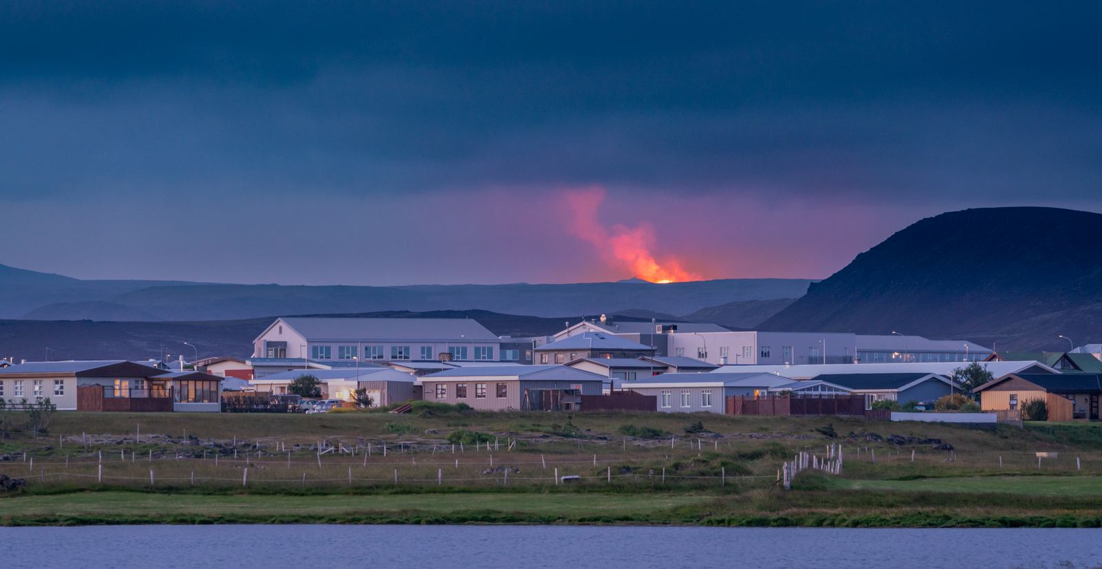
06Grindavík
Grindavík is a fishing town on the Reykjanes Peninsula that has experienced significant volcanic activity in recent years. Explore the harbour, see cooled lava and fissures, enjoy local seafood, or visit nearby attractions. Allow 1–3 hours for a visit, or stay overnight while exploring the Volcano Circle.
Discover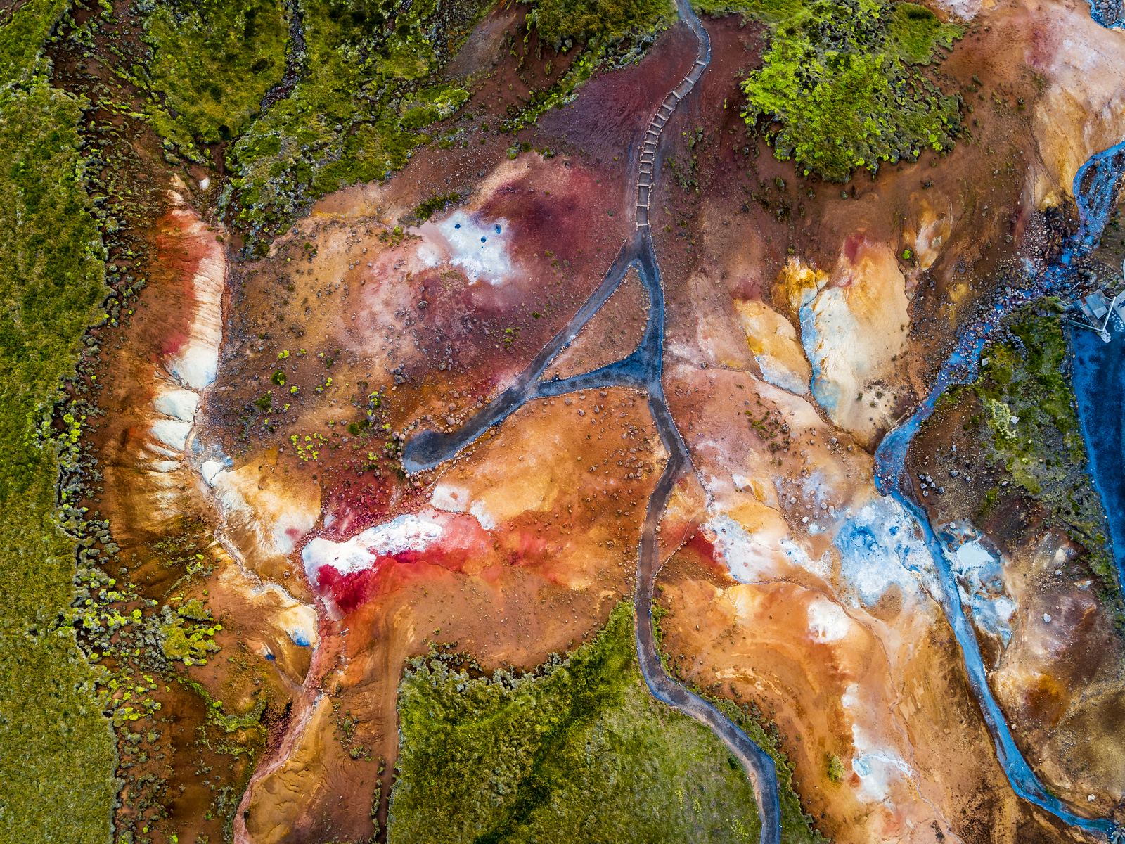 03
03Krýsuvík & Seltún
At Krýsuvík & Seltún, the geothermal activity is noticeable as soon as you step out of the car. You can see the steam, hear the bubbling mud pools, and smell the sulphur in the air. Follow the boardwalk for a closer look at the geothermal features that make this one of the most distinctive stops on the Reykjanes Peninsula.
Discover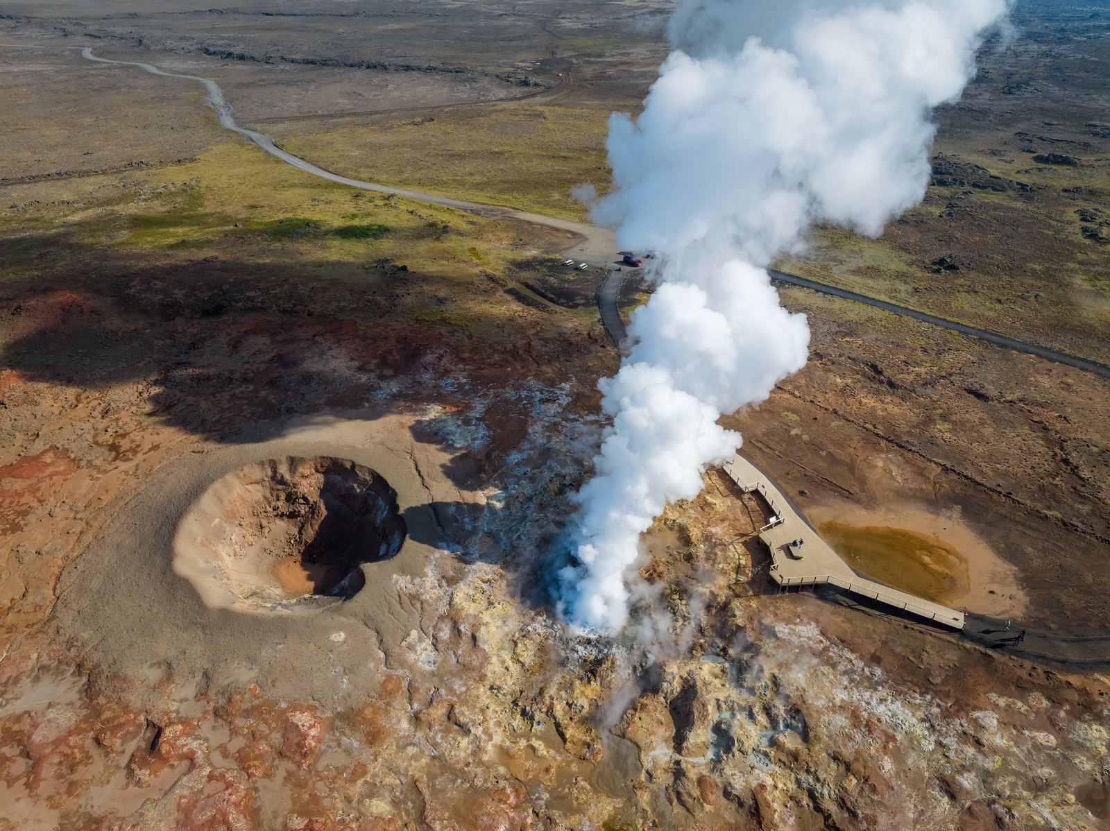 09
09Reykjanes Geothermal Area
Explore the steam, hot ground and volcanic landscape around Gunnuhver at the southwestern end of Reykjanes.
Discover